


SityTrail hiking trail GPS
Descriere SityTrail hiking trail GPS
Du-te și descoperi toate căile din întreaga lume
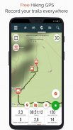
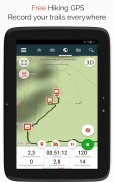
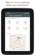
• Înregistrați-vă traseele în timp ce faceți fotografii HD și geo-etichetate ale aventurilor voastre.
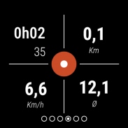
• Distanța parcursă, Km-efort, viteza medie, caloriile arse etc.
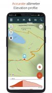
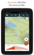
• Altimetrul precis, calculul diferențelor de înălțime și profilul de altitudine care afișează locația dvs. curentă.
• Alarmă când ieși din calea traseului urmat. Nu mai e nevoie să dai înapoi!
• Declanșarea automată a punctelor de interes cu text-to-speech.
• Creați un cont gratuit și toate datele dvs. vor fi disponibile peste tot pe fiecare dispozitiv.
• Creare ușoară de trasee și puncte de interes de pe site-ul nostru.
• Cu editorul nostru online, creați-vă propriile trasee folosind un browser Web pe PC/Mac și apoi accesați-le direct de pe smartphone pentru a le experimenta pe teren.
• Sortați și clasificați traseele și punctele de interes în propriile liste.
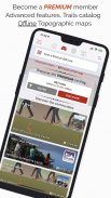
Mergeți mai departe și deveniți utilizator PREMIUM!
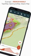
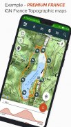
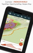
• Descărcați hărți topografice mondiale pentru utilizare offline.
• Descoperiți trasee de drumeții GR, trasee de drumeții europene, trasee Santiago de Compostela pentru pelerini etc.
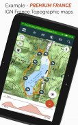
• Adăugați hărți topografice la alegere, de la IGN Franța, IGN / NGI Belgia, IGN Spania, swisstopo, Austria, SUA (USGS topografică cartografică), Canada (Toporama).
• De asemenea, puteți descoperi toate rețelele de ciclism: rețeaua de drumuri verzi în Franța, Ravel în Belgia, trasee europene de ciclism, rețele de puncte de noduri în Flandra și Olanda.
• Și iarna, descoperă toate pârtiile de schi cu numele lor.
• Accesați catalogul public de trasee de la membrii și comunitățile SityTrail.
• Funcții avansate de urmărire și ghidare cu calculul distanței și timpului rămas și instrucțiuni vocale la intersecții.
• Mergeți mai departe și transformați traseele preferate în ghiduri multimedia reale cu text, fotografii, linkuri video și partajați-le comunității SityTrail.
• Creați-vă propriile comunități de drumeți și gestionați-vă membrii și fluxurile de știri.
• Creați trasee cu funcțiile noastre avansate pentru editarea traseului prin intermediul site-ului nostru web.
• Imprimați trasee în format PDF cu coduri QR. (A4, A3).
• Accesați articolele Wikipedia geoetichetate din modulul nostru SityTrip.
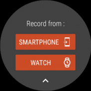
Înregistrați un traseu pe ceasul dvs. Wear OS
Puteți înregistra un traseu pe ceasul dvs. Wear OS în modul de sine stătător (nu este conectat la un smartphone Android) sau în modul asociat (conectat la un smartphone Android).
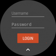
Aplicația vă permite, de asemenea, conectarea la contul dvs. SityTrail existent (din ecranul care este cel mai mult din stânga) atunci când ceasul este utilizat în modul de sine stătător.
Informații importante
• Unele funcții necesită o conexiune la internet.
• Utilizarea prelungită a GPS poate reduce nivelul bateriei.
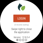
SityTrail hiking trail GPS - Versiune 12.15.8.4
(04-07-2025)SityTrail hiking trail GPS - Informații APK
Versiune APK: 12.15.8.4Pachet: com.geolivesCea mai recentă versiune a SityTrail hiking trail GPS
Alte versiuni


Aplicații din aceeași categorie


S-ar putea să îți placă și...


